A bit dry and academic with a lot of “talking to my dataset” but some interesting bits on trends in modern warfare including early parts of Ukraine war. 3/5
$600 to Givewell Top Charities fund . I’ve been donating to Givewell as my main “help the poor” charity since they have fairly low overheads and try and get the most impact from their donations. They also get good reviews for living up to these goals.
My employer matched this donation so total given to Givewell was $1790.
Software and Internet Infrastructure Projects
The Software Freedom Conservancy use Paypal which is blocking charity donations from Asia/Pacific so I was unable to donate to them. Software in the Public Interest was previously not working but worked this year.
As I covered in my plan for a Metro Line from Takapuna to the Airport getting across Auckland Harbour is difficult. The problem is that while a bridge would be cheaper and have the option of a pedestrian/cycling lane the requirements to allow a 43 metre clearance for ships would require a line too steep for rail to climb
In my plan I ended up going for a tunnel under the harbour as I couldn’t make the bridge option work.
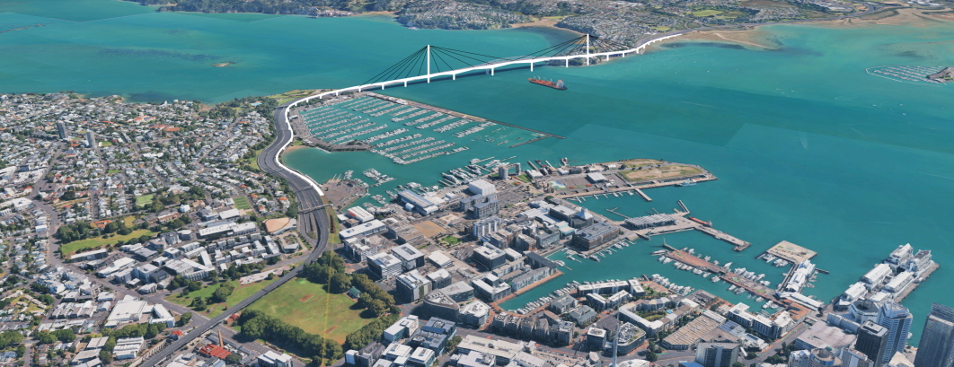
However recently “ifuckinghatethe394” on discord suggested a new option for a bridge. The trick is to run the line parallel to the existing bridge and motorway but have it start climbing much earlier than the motorway does. In the case of the line south of the Bridge it would begin climbing some 500m earlier.
This would means it could reach the required height using a slope that trains, pedestrians and cyclists could easily manage.
Their Concept
The new line (in white) would start from the south at a line going under Victoria park. It would emerge at the southern end of St Mary’s Bay and climb from there (shown as white) steadily until it became a new bridge just east of the existing bridge. It then decreases height to become an elevated line north of the Harbour.
Review of their idea
The good bit about their idea it uses the extra distance the line is traveling to gain height. Alternative ideas (including my own) have assumed the train gains height in a straight line and then had problems fitting that straight line across Auckland Harbour.
I’m less sure about their route South of the new Bridge. They show the line going underground where there are currently road lines into Fanshawe Street. I have proposed an alternative route below.
My Proposal based on their idea
I would go for a two line light-metro bridge with a 5 metre wide cycling and walking path on the east (water) side. The path could also have slightly wider bits for observation at various point. The light metro would join lines to the North and South as outlined in my previous proposal.
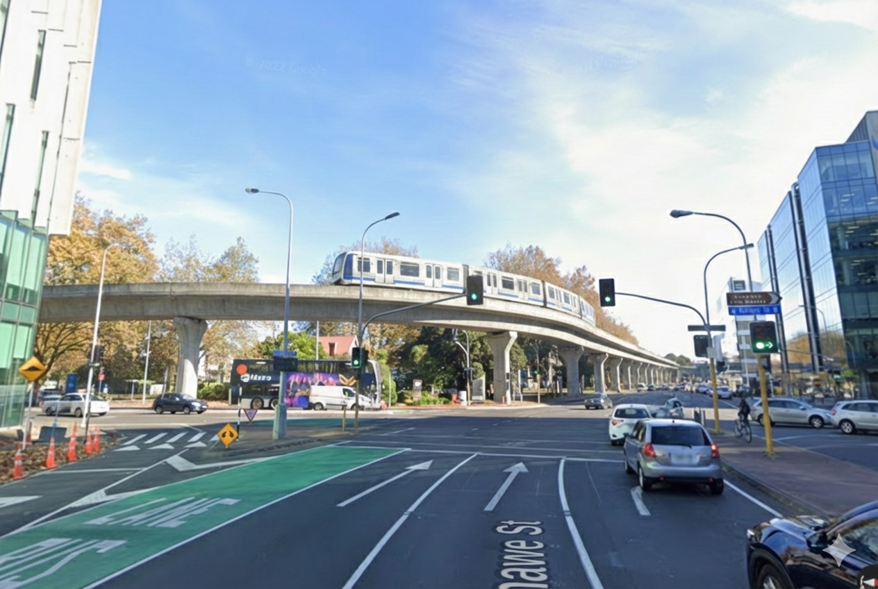
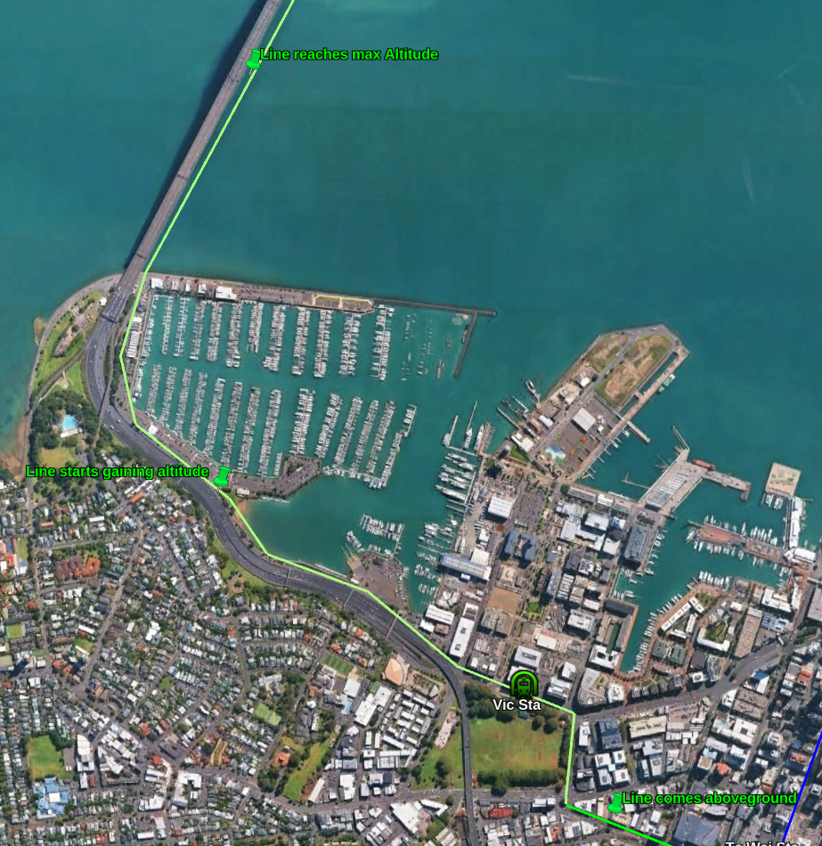
I think that a better option is to have the Light Metro line under central Auckland come out of the ground near the City Works Depot. The line can the go elevated about 10m above the street by the bottom of Wellesley Street West. Then it should turn right into Halsey Street. After going a block down Halsey street it turns left into Fanshawe Street and has a station half way along the block near where the existing bus stop is. Light Metro has a turning radius of around 40-50m so should be room to negotiate these corners.
Ai generated of line turning from Halsey St into Fenshawe St
The line should then switch to the harbour side of the road and follow the motorway along the east (Harbour) side. Around the Westernmost point of St Mary’s bay the cycle/walking path should join the rail-lines and then it should start gaining altitude until it reaches it’s target height (around 46m above sea level) near the middle of the bridge.
The line would climb from 10m to 46m over a distance of 1200m or a 3% gradient. This is well within capabilities of standard metro systems. It is also okay for cyclists and pedestrians.
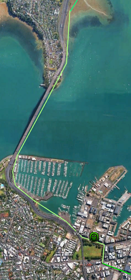
After going flat for a couple of hundred metres the line would start down agin on the North side of the bridge reach 10m around the police station. The cycling/walking path could then cross the motorway and terminate on Stafford Road while the rail line continues North.
Another option for the path would to have an exit at Stafford road but continue the rest of the path 6km North to Akoranga station (or nearby). This would allow people to cycle all the way from Takapuna to the city.
Comparison to the Tunnel Option
My previous version had a tunnel all the way from the Central city to just off Sulphur Beach. It also had an underground station under Victoria park.
Cost of Underground option from Wellesley St West to Sulphur Beach
3km underground line – $3000m
1 underground station – $250m
Harbour Tunnel extra – $500m
Total – $3,750m
Cost of Elevated Line and Bridge between same points.
4km elevated line – $1200m
1 Elevated station – $25m
Harbour Bridge extra – $500m
Total – $1,725m
So the rough saving is $2 billion. Mainly due to elevated lines being so cheap compared to underground.
Route of undergroundRoute of Bridge option
Conclusion
The new proposed route seems a great idea which fixes the main problem with previous bridge proposals.
Substituting a Bridge for a Tunnel saves substantial amount of money ( $2 billion in my estimate above) and also provides Active Transit options and a possible tourist destination.
A single volume covering the period. Covers the campaigns only in passing to use space for other areas. Very good and managers to cover all countries. 4/5
An engineer on the Apollo and Shuttle programs writes about his career and experiences. Some interesting stories and insight into areas not covered by most books. 4/5
A second memoir by Lowe. Usual anecdotes about showbiz and celebrity life mixed in with stories of family. Not as good as the first book but still okay 3/5
A memoir covering the NZ Prime Minister’s life up to shortly after she resigned. Best bits are her early life while her time as MP and especially Prime Minister is reduced to a few events. 4/5
How isotopes are used to date events from the recent to distant past and find out other things like the atmosphere’s composition millions of years ago. Worth reading 3/5