Introduction
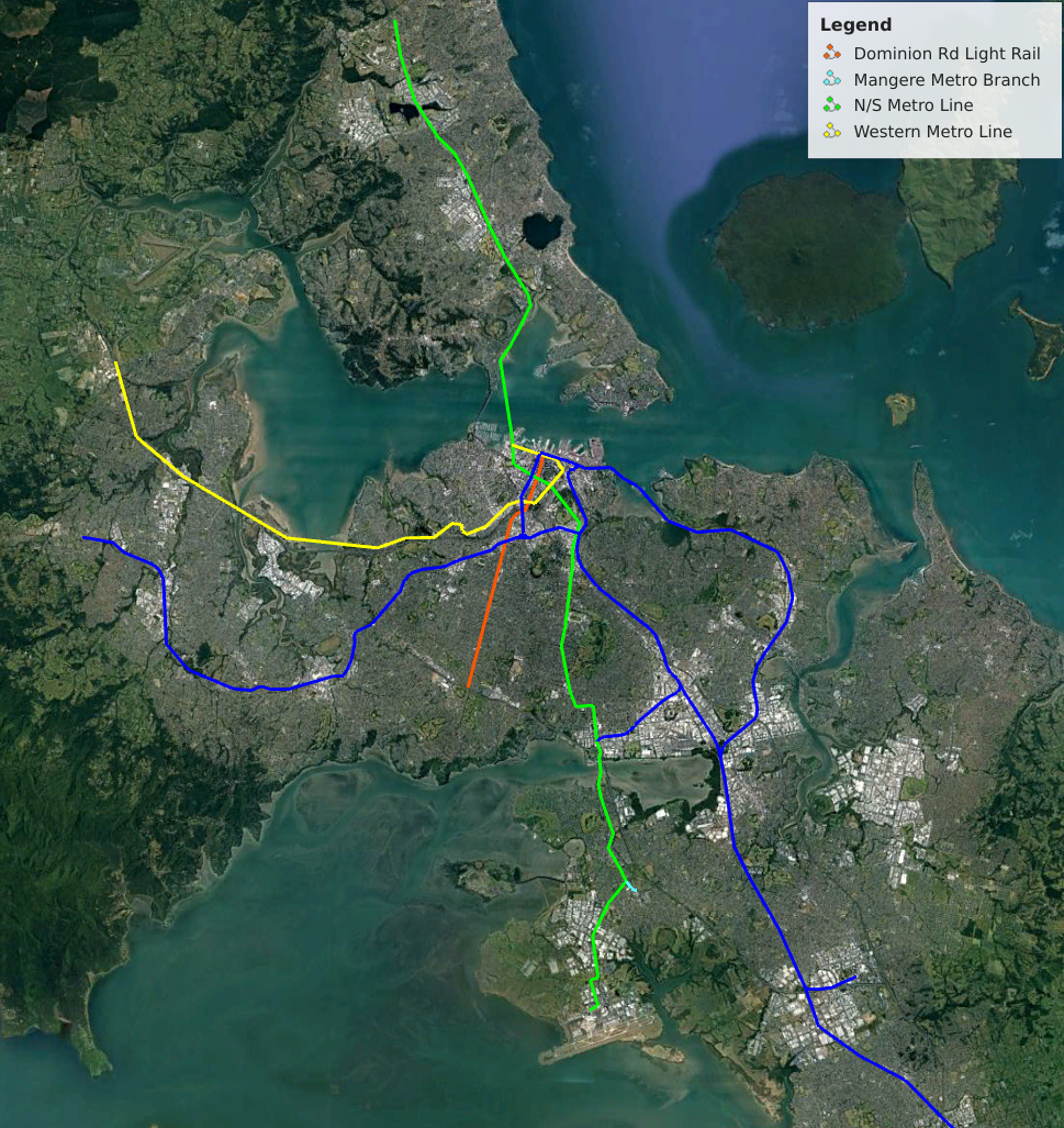
In my previous article I covered why Light Metro is the best technology of the next major stage of Auckland’s train network. Here I present a couple of lines that could be the basis for a future network.
The lines are designed to form a mesh an enable transfers (especially in the CBD) but are of course just ideas. One problem I have encountered is steep sections of track, these will require the track to smooth our the height differences and for trains able to handle climbs of around 5%.
I am estimating costs as $300m/km for elevated sections and $1b/km for underground sections. Hence I have used elevated line wherever possible.
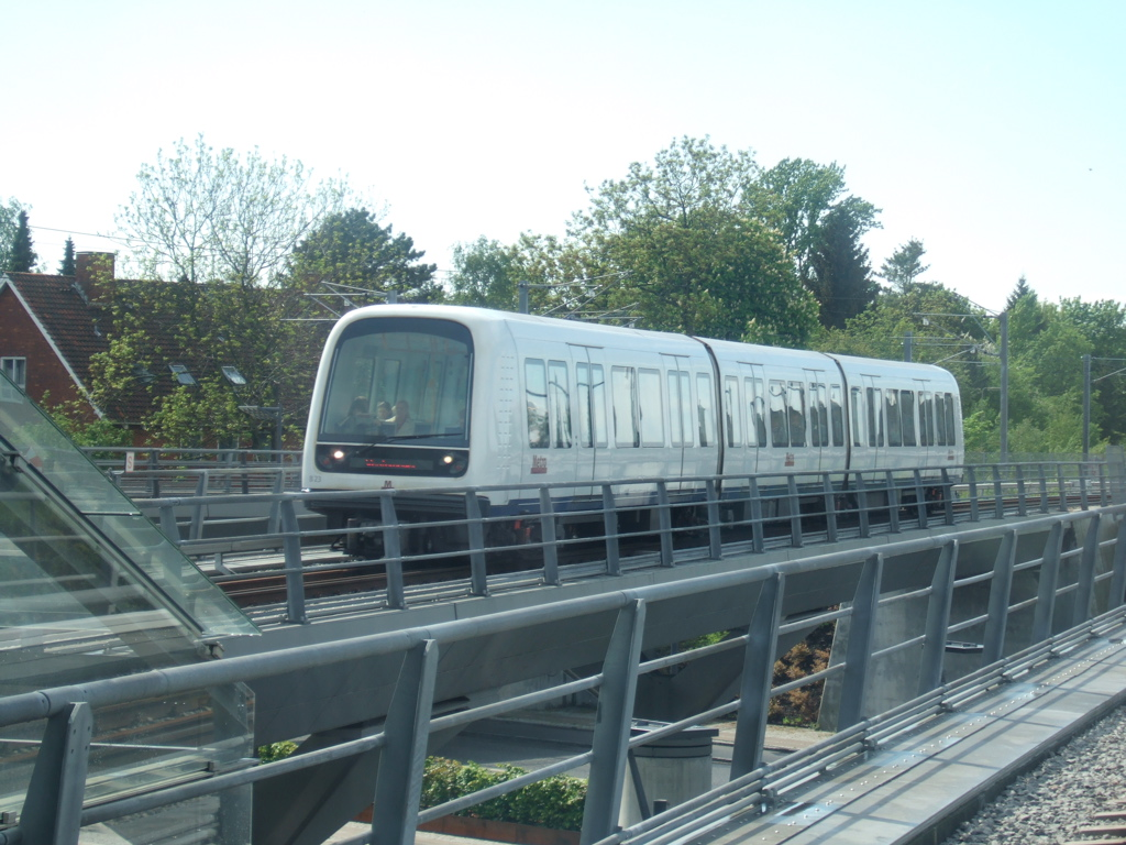
Light Metro Technology
As outlined in my previous article Light Metro is Automated, Grade Separated with Short Trains and High Frequencies. It is well suited to Auckland where requirements exceed Light Rail but a full metro would be overkill.
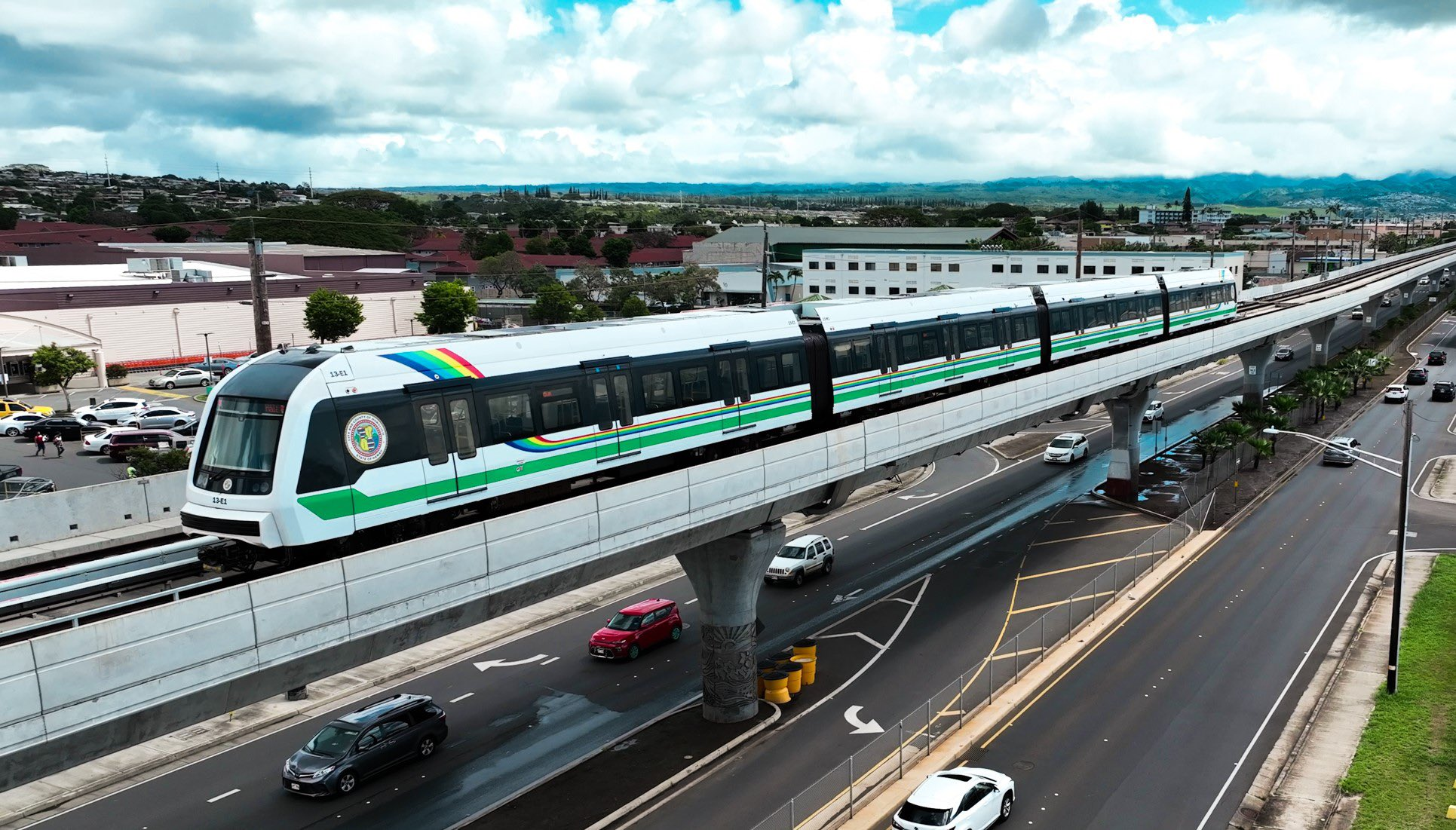
The key advantages of Light Metro over street running light rail is it’s high capacity, frequency and higher speed. Attempting to push Light Rail beyond it’s natural sweet-spot result in a grade-separated system that costs as much as Light Metro but is worse and often costs more to run.
The below table shows the capacity of a Light Metro line (in each direction). For Auckland the stations outside the CBD could be serviced by buses to further increase coverage area. Trains could start at short length and frequency increased as high as possible before longer trains should be used.
| Headway / Trains per Hour | 2 Cars | 3 Cars | 4 Cars | 6 Cars |
| 5 min / 12 tph | 2,400 | 3,600 | 4,800 | 7,200 |
| 3 min / 20 tph | 4,000 | 6,000 | 8,000 | 12,000 |
| 2 min / 30 tph | 6,000 | 9,000 | 12,000 | 18,000 |
| 90 sec / 40 tph | 8,000 | 12,000 | 16,000 | 24,000 |
If the system is run with 4-car trains then each has the capacity over double one of the major Auckland motorways such as the Western or Southern.
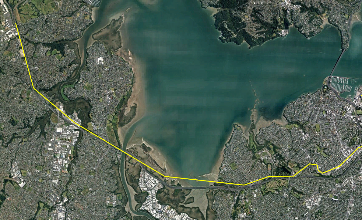
Line 1 – A North/South Metro Line from Albany to the Airport
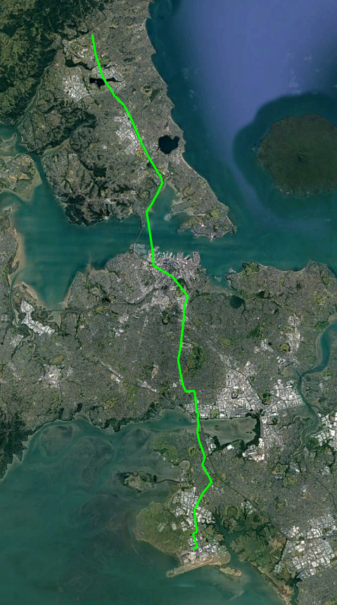
This line would upgrade the Northern Busway on the North Shore, run under the CBD and connect to the Airport in the South.
The line would be grade separated above the road as much as possible since this is cheaper than under-grounding. It would be underground though the central city however.
Total length would be around 36km of which around 5.5 would be underground. Cost would be something like $15b
Northern Section
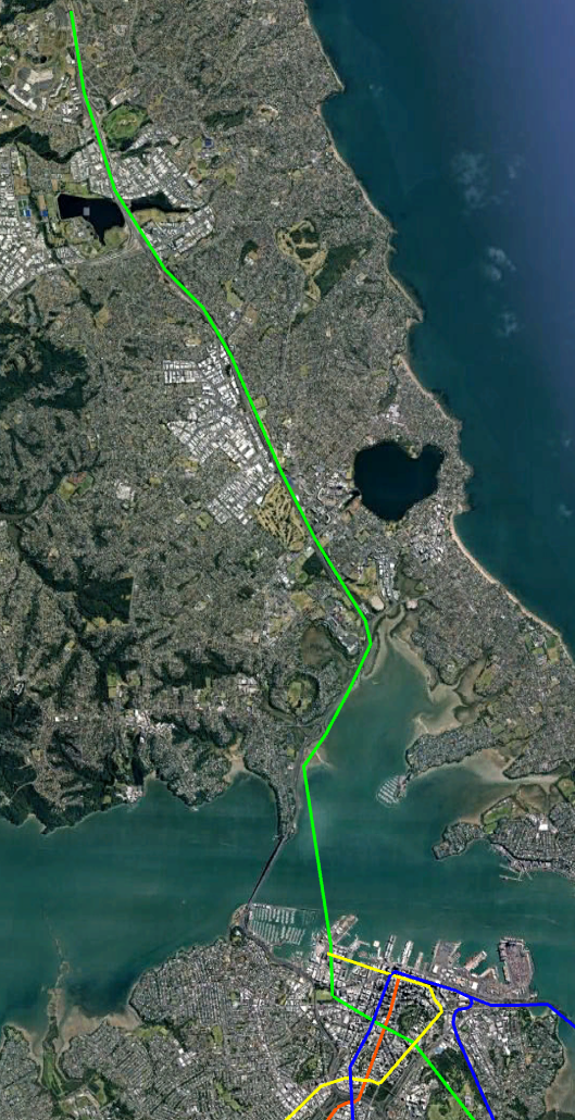
This would start at the exiting Albany bus centre and follow the Northern busway to Akoranga station. It would then go along the shore until roughly opposite Sulphur point where it would either go in a tunnel or bridge over the Harbour to Wynyard Quarter. Stations would be Albany, Rosedale, Constellation, Sunnynook, Smales Farm, Akoranga
The Northern Busway should be kept South of Akoranga Station for use by buses from Takapuna, Northcote and Brikenhead. This would give the system more capacity and is easier than those people transferring from a bus to a train for such a short ride.
Travel time from Albany to the Te Waihorotiu Station (Aotea) should hopefully be around 25 minutes.
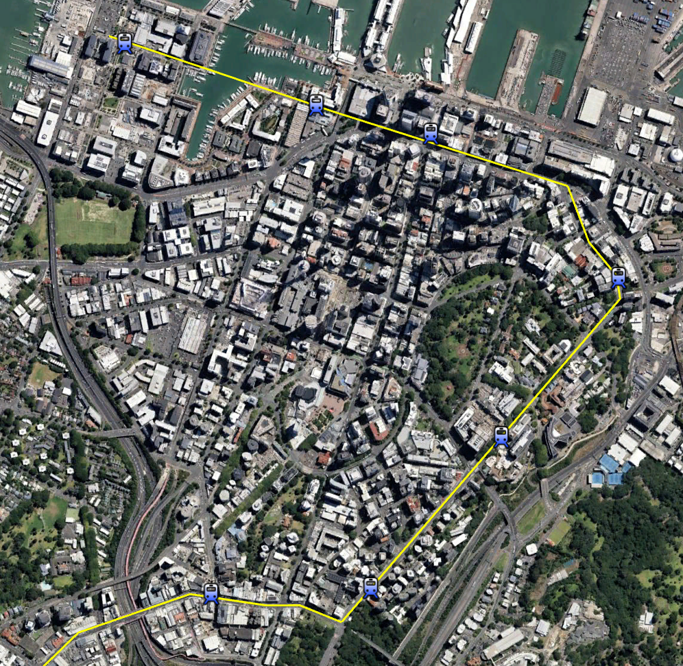
City Section
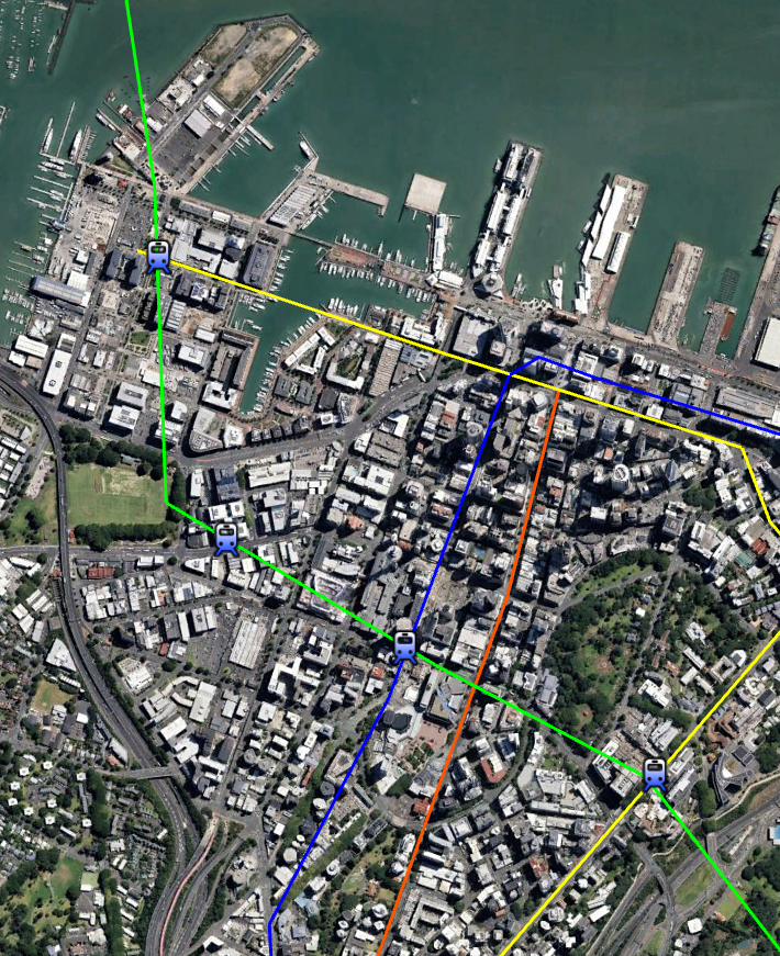
Once over the Harbour the line should head underground and have a series of stops in the Central City. I would suggest
- Central Wynyard Quarter near Madden St
- Near Les Mills on Victoria St West
- Te Waihorotiu Station (Aotea)
- University / Symonds St
The Te Waihorotiu CRL station is apparently already future-proofed with space for a North/South line. The station will effectively be the centre of the Auckland System. There should also be a surface Light Rail line nearby on Queen Street.
The University station would be quite deep and probably be a an elevator-only station.
Southern Section
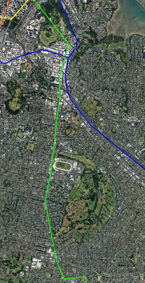
South of Grafton Valley the line would go under the domain before going through Newmarket. The line could either be above or below ground though Newmarket but will be above ground once it reach Manukau Road.
I don’t think having a station for the Museum is justified but there could also be a station at the North of Newmarket near Sarawia St. There should be at least one station in Central Newmarket near the existing Train station to allow transfers
South of Newmarket the line will travel above Manukau Rd and continue South through Onehunga and Mangere Bridge.
Possible stations could be (at roughly 1km intervals):
- Near corner Manukau and Great South Road
- Corner of Manukau Rd and Ranfurly Road
- Corner of Manukau Rd and Queen Mary Ave (Alexandra Park, Green Lane West Rd)
- Corner of Manukau and Pah Roads
- Royal Oak Mall
- Corner of Manukau Rd and Trafalgar St
- Onehunga Mall Road near Grey Street
- Onehunga Station
- Mangere Bridge Village
- Corner of McKenzie and Millar Rd
- Corner of Bader Dr and Idlewild Ave
- Mangere Town Centre (see below)
- Airport Drive Area
- Airport Terminal
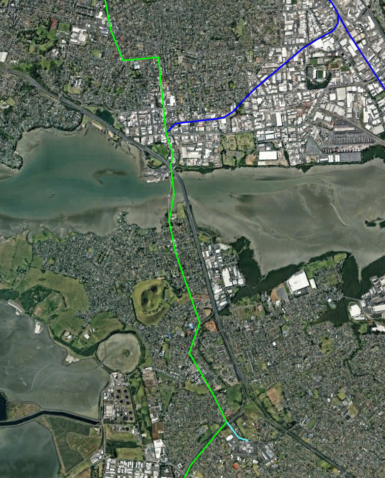
The Southern Section would have roughly 16 stations and take over 18km and would take around 30 minutes to cover from the Airport to Te Waihorotiu/Aoetea Station.
Previous proposals have followed the motorway but I’ve switched this to following roads inside the suburb of Mangere Bridge and giving the suburb 3 stations with the Millar Rd one having good connectivity to Favona.
The Mangere Town Centre station would be a branch off the Bader Drive station. It could be run as a shuttle. Eventually the line could be extended East along Buckland Road to Papatoetoe Station then North to Otara and/or South to Manukau
Line 2: North-West Metro Line from Westgate to the City
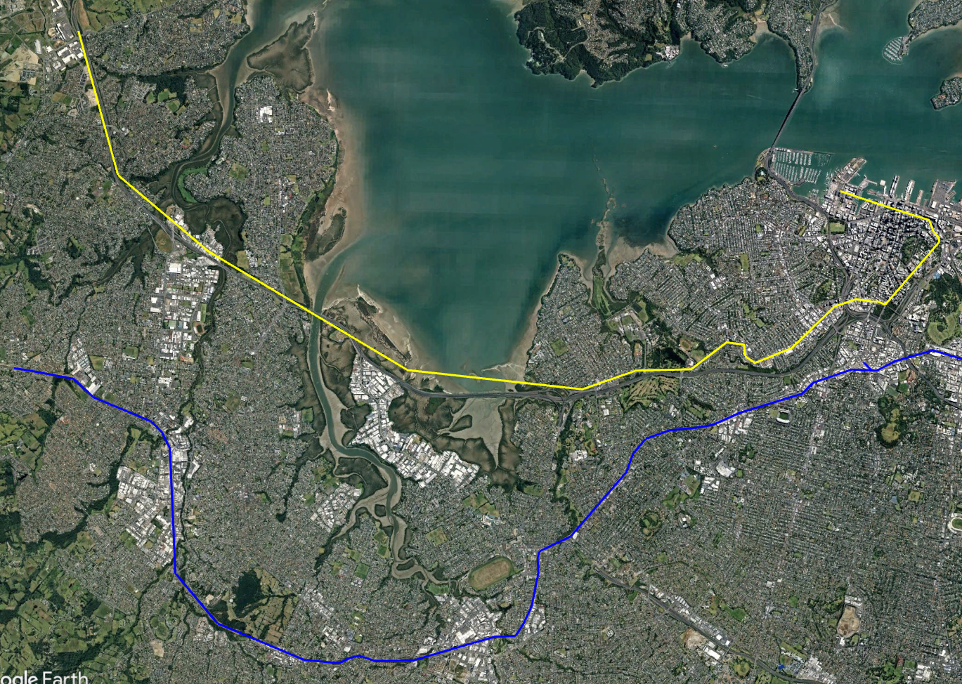
This line is intended to fill the gaps to the North of the existing Western Rail Line and use the Motorway corridor. Closer to town it will go above Great South Rd and Karangahape Rd.
It will then do an above-ground spiral around the city to improve coverage and transfers.
Total length would be around 20km and all above ground. Cost would be something like $6b
Western Section
This would run from Westgate to Karangahape Road mainly along the North Western Motorway and Great North Road (GNR). It would be roughly 16km long and 100% overhead.
Stops could be: Westgate Shopping Centre, Royal Road, Huruhuru Road, Lincoln Road, Te Atatu Road, Rosebank, Point Chevalier Shops, Zoo / MOTAT, Corner GNR & Bond St, Corner GNR & Williamson Ave, Corner GNR and Newton Rd, St Kevins Arcade.
City Section
The St Kevins Arcade stop on Karangahape Rd should be designed to allow people to easily transfer to either the Dominion Rd Light rail on Queen St or the Karanga-a-Hape CRL station.
After the St Kevins Arcade stop the line continues east along Karangahape Rd and then turns down Symonds Street, Anzac Ave, Customs Street and then across the Viaduct Basin to Madden street.
- St Kevins Arcade
- Symonds St near City Rd
- Symonds St near the Engineering School
- Symond St near Parliament St
- Customs St near Britomart
- Customs St West near Market lane
- Madden St near Daldy St
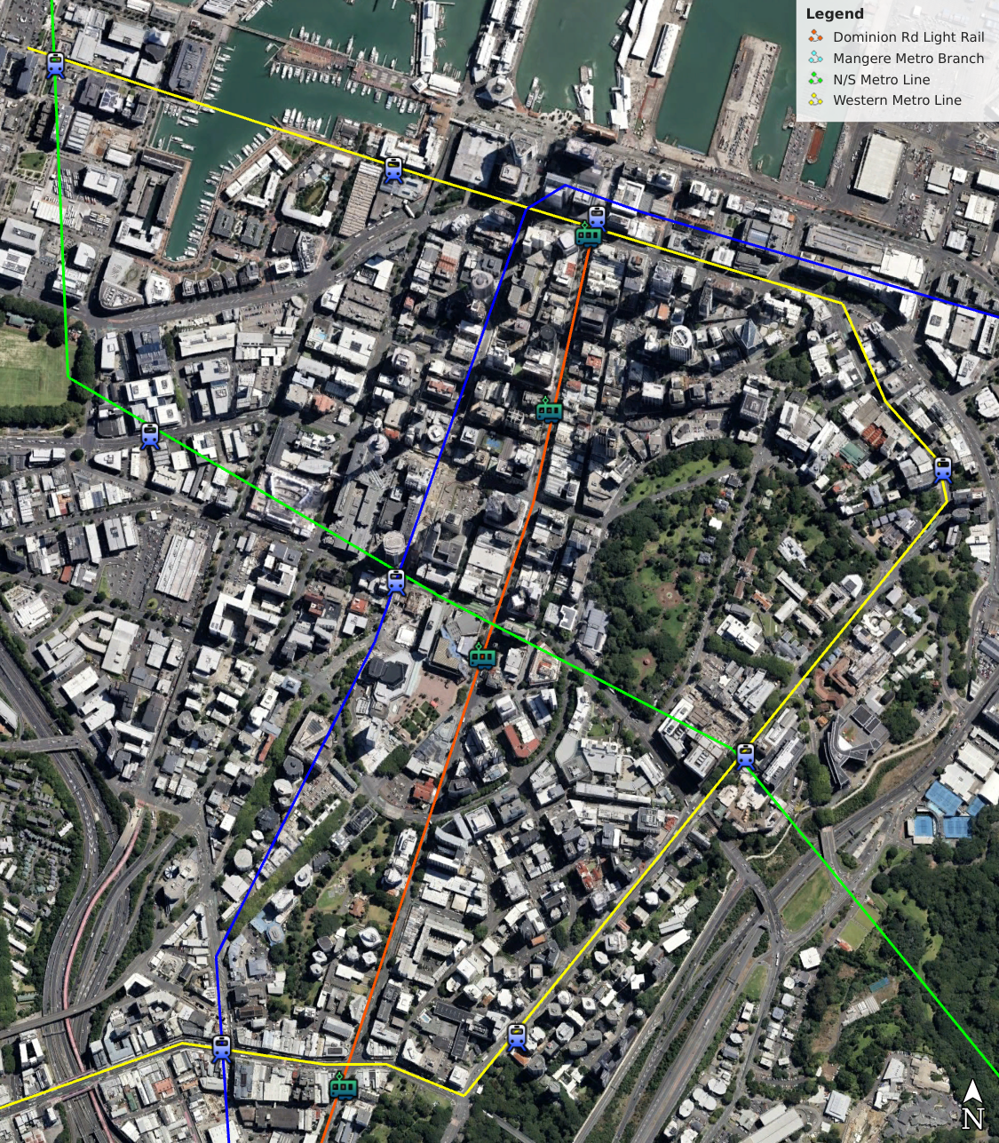
The line has seven stations in the CBD and intersects all the other lines twice. This enhances the coverage of the other lines via transfers. Extra stations are also a lot easier and cheaper to build on this line than the underground lines.
eg Someone coming from the North Shore on the N/S Metro could get off at Wynyard Station and Transfer to the Western Metro Line. They would then only have to wait a couple of minutes to catch a train to the Britomart station.
Dominion Road Light Rail
This has been covered elsewhere in detail but building a Lower Queen St to SH20 surface Light rail line fills a gap in coverage and provides additional capacity along Queen Street fairly cheaply.
The line would be mostly separate from car traffic on dedicated lanes in the Center of Dominion Rd and Queen Street. Length would be 8km.
Followups Lines
The above two lines probably give Central Auckland significant metro coverage to last many years. Future lines in Ponsonby, Sandringham, Mt Eden, The CDB, and Newmarket would probably be best served by cheaper street running light rail.
Further out Light Metro may suit the longer distances. Lines or Branches like:
- Te Atatu
- Point Chev to Onehunga
- Mangere to Papatoetoe
- Papatoetoe to Otara and then on to Botany
- Manukau to Papatotoe, Howick and Manurewa
- Takapuna
- Orewa
Areas like Remuera could use either technology or just retain bus-based feeders
Questions
Q: Why not Light Rail?
A: Steep running light rail is suitable for many sections but it lacks the higher capacity and speed of Light Metro. This is need for long busy routes like the link to the North Shore. If you Grade Separate the Light Rail then you end up spending as much as Light Metro for an inferior product.
However Light Rail is suitable for many routes that don’t justify the extra speed/capacity. This includes Dominion Road and additional filler routes around the CBD that need a step-up from buses.
Q: Why not Heavy Rail?
A: A System compatible with New Zealand’s current service would not work. It would not be able to handle turns, climbs and automated operation without extremely expensive changes which would lose all compatibility. The existing routes (including the CRL) are already full so no savings via reuse is gained.
Q: Why elevated instead of tunneled?
A: Because it is cheaper. Cost for tunneled is usually at least twice that of overhead and can often be more. Yes, not everybody likes the look of overhead lines but going underground can increase the cost by enough to derail the project.
Q: What about steep sections?
A: Certain section of the lines are quite steep due to Auckland’s terrain. This may cause a problem with the route. Light Metro can handle steep slopes than Heavy Rail but handling it may require additional measure like altering the height of lines so they smooth out slopes.
